On and Off the Beaten Path: A Story of Two Parks
Part 1: On the Beaten Path at Parque El Boquerón
The San Salvador volcano is called the sleeping giant for good reason. It is a geographically broad, primarily stratovolcano made up of layers of built-up lava and tephra (ash, cinders and rock that blasts out as pyroclasts during an eruption and then settles). Stratovolcanoes are usually cone-shaped. More than 40,000 years ago, the immense, conic San Salvador volcano dominated the landscape of El Salvador. A mammoth eruption truncated the volcano, leaving behind an ancient crater in which the Boquerón volcano grew. About 800 years ago, Boquerón erupted and the central cone collapsed, leaving behind a crater lagoon and the profile which we recognize as the San Salvador volcano today.
In the photo, El Boquerón is situated in the center of the flatter slope, to the west of the current peak. The steeper part of the volcano is called El Picacho and is the tallest part of the San Salvador volcano. On the topographical map, El Picacho is located at the high point of the ridge between the crater of El Boquerón and the city of Mejicanos. That ridge is part of the rim of the crater left behind by the prehistoric eruption. Calle al Volcan is the road that cuts between the Boquerón crater and El Picacho. This road is familiar to anyone who has visited El Boquerón park, dined at a restaurant on the side of the San Salvador volcano or driven over the volcano from Santa Tecla to Quezaltepeque.
The San Salvador volcano is a giant. The volcano is made up of 3 stratovolcano cones (Boquerón, Picacho and Jibali), 14 pyroclastic cones, various fissure vents, lagoons, craters and other geologic features. Most of the recent volcanic activity (since 1200 CE) has taken place on the northern side of the volcano. The last eruption of the San Salvador volcano occurred following 3 strong earthquakes which destroyed much of San Salvador and the surrounding area on June 7, 1917. This video contains many historic photographs and an excellent explanation (in Spanish) of the series of seismic and volcanic events which took place from June 7th through June 29th, 1917. During that eruption, the lagoon in the crater of El Boquerón boiled and evaporated, and a small cinder cone formed, known as El Boqueroncito.
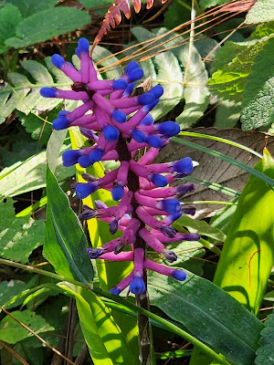
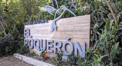
El Boquerón is often referred to as the Sleeping Giant, and because the mountain is asleep, it has become a lush and beautiful home for all kinds of creatures, including humans. The sides of the volcano host forests and coffee farms, fruit trees and flowers, lands sacred to the indigenous people and commercial development. Located on the rim of the Boquerón crater, Boquerón National Park has been a favorite tourist destination for international and Salvadoran tourists since 2008 (the official opening of the park). A blog story I wrote in 2010 features a beautiful orange toilet brush flower and is set in the park. Over the past 15 years, I have visited this park at least once a year, but typically multiple times per year as a regular recreational and therapeutic destination for delegations and Salvadoran friends.
 |
| The gardens feature native and non-native cultivars |
 |
| The old museum featured some hands-on exhibits and told the story of the 1917 eruption which featured video testimony from elders who experienced the earthquakes, ashes and lava flows as children. |
 |
| Over the years, the pathways were moved and stairs reconstructed to prevent erosion. This was the path at the rim in 2019. |
In 2023, the government did a major improvement project in the park. There is now controlled parking at the top where you pay to enter and park a vehicle. Due to limited space, a line often forms at the pluma (entry gate). You can let a person out to pay for your group, which allows everyone to exit and start walking while the driver waits in line to park. The museum has been reconfigured with Spanish and English panels that give the history of the volcano. (It is a little boring for young ones or those who don't care to read lengthy descriptions.) There are restrooms near the museum (and also near the new lookout and new coffee shop up at the rim).
 |
| Shops and restaurants just outside of the museum entrance are definitely worth checking out, but also are cause for frustration for drivers. (Photo credit: Pam Klink) |
Just off of the parking lot on the side opposite of the museum, there is a very steep ramp to a lookout. If it is a clear day, you definitely want to take advantage of the view. You might be able to pick out landmarks in San Salvador, Lake Ilopango, and the San Vicente Volcano. It's a good activity while you wait for your driver to park or while folks use the restrooms.
 |
| View from the parking lot lookout |
After visiting the museum, the first bit of the walk to the crater rim consists of a long concrete ramp, followed by a boardwalk. The park is accessible to those who use wheelchairs up to this point. These structures do take away from the rustic and natural aspect of the park, however, it is lovely for those with mobility challenges to be able to enjoy a part of the forest and garden space.
 |
| (Photo credit: Pam Klink) |
The walkways and stairways have been rebuilt. The climb takes about 20 minutes up to a height of 1640 ft. above sea level. It is important to drink water and pause to rest, especially if you are not used to the heat or the elevation. I notice that visitors tend to walk fast to get to the rim, but I suggest taking some time to notice the birds, insects and flowers along the way.
 |
| (Photo credit: Joanna Salinas) |
 |
| (Photo credit: Pam Klink) |
During a visit a few weeks ago, I paused on the stairs to ask the workers what they were doing. The guy in the background told me they were digging an aqueduct so water can flow down into a turtle pond. I remembered there were once a couple of side paths to stone cisterns for gathering rainwater and making wishes. Suddenly the guy in the foreground hit something with his shovel and said to me, "You need to take a photo of this!" He set these rocks on the ledge for me to see. He told me they were very old from a previous explosion of the volcano. He really was so excited to show me these rocks! And he went right back to work.
 |
 |
| View down from the stairs up to the crystal lookout |
Of course the goal is always to catch a glimpse of El Boqueroncito. Along the rim path, there are several good spots for taking photographs.
Depending on the time of year, there are flowers to observe both on the ground and in the trees and soaring birds riding the thermal air currents inside the crater. Just before you come to the descending path, you arrive at the lookout plaza (with the big cell antennas) which now has a little coffee shop. It's worth pausing a moment for a cup of coffee or a cold drink.
Parque Nacional de Boquerón is a fun spot to relax if you are in the center of the country and have from 1 to 3 hours of free time. The park opens at 8 AM and closes at 4 PM, but if you have already entered, they will not kick you out until 5 pm. If you go in the morning, you can stop for coffee or lunch on your way back down the volcano. After an afternoon visit, you might like to grab dinner at a spot with a view to watch the sunset and the lights go on in the city. Traffic on Calle al Volcan is horrific on the weekends, so a weekday visit to El Boquerón is the best choice.


Comments
Post a Comment